










Help Us Bypass Censorship. Share This.
Sign up to receive Our Weekly Briefing Newsletter
Begin your journey with weekly insights designed to expand awareness and ground you in truth. Our free tier gives you a powerful introduction without any commitment.
SPECIAL WEATHER WATCH | NOVEMBER 2026 – MAY 2027
Super El Niño • Three Atmospheric Rivers • Extreme Flooding • Landslides • Tornado Outbreaks • Regional Weather Disruption
“The emerging warning is not simply the possibility of another powerful storm. It is the convergence of multiple extreme-weather systems within compressed time windows, creating conditions in which one disaster may begin before communities have recovered from the previous event.” — Great Awakening Report
THE EMERGING PATTERN | MULTIPLE WEATHER THREATS, ONE LARGER CONVERGENCE
The 2026–2027 weather outlook is drawing attention to a potentially significant period of extreme weather across the Pacific Basin and the United States. A changing Pacific climate pattern, an active storm track, and the possibility of repeated atmospheric-river events are creating conditions that deserve close attention. The greatest concern is not necessarily one powerful storm, but the possibility of several major weather systems arriving before affected communities have time to recover.
Adding another dimension to this outlook is an experimental predictive simulation developed through Kevin L. Brown’s Creation Unified research framework. Using an AI-assisted process known as the Information Substrate Simulation Protocol (ISSP), the project identified three weather periods extending from late summer 2026 through spring 2027. The proposed sequence includes a Pacific tropical-cyclone rainfall event, a concentrated winter flooding period, and a spring severe-weather outbreak across portions of the southern United States.
Brown’s approach explores a proposed Phase Overlap Amplification hypothesis, which suggests that overlapping solar, lunar, and terrestrial cycles could intensify atmospheric responses. This remains an experimental concept rather than an established forecasting method, and its predictions have not been independently validated. Nevertheless, the broader issue it raises deserves consideration: What happens when extreme-weather systems arrive in rapid succession, creating cumulative damage that exceeds the impact of any individual event?
That question forms the central focus of this report. Rather than treating the proposed timeline as a certainty, we examine its three weather scenarios alongside established meteorological patterns, the potential influence of El Niño, and the infrastructure vulnerabilities that can turn repeated storms into prolonged regional emergencies.

THE PACIFIC CYCLONE THREAT — AUGUST THROUGH OCTOBER 2026
The first event identified in the experimental simulation focused on a potentially destructive tropical cyclone or remnant-moisture system in the eastern or central Pacific. Its projected window extended from August through October 2026. Unlike a conventional hurricane scenario centered on wind speed and storm classification, this prediction emphasized inland rainfall, flash flooding, and infrastructure damage as the most consequential threats.
That distinction is important because tropical systems can transport enormous quantities of moisture even after losing hurricane strength. When this moisture reaches mountainous terrain or flood-prone communities, rainfall can become more destructive than the storm’s original winds. The American Southwest is particularly vulnerable to these conditions, where steep terrain, dry washes, and rapidly developing runoff can produce dangerous flooding far from a storm’s original circulation.
Because the August–October observation period has already passed, this prediction can now be compared with actual Pacific storm records and documented flooding. Its inclusion here provides context for the larger proposed sequence, but it should not be treated as a confirmed event without that comparison. The underlying concern remains relevant: the most damaging consequences of a tropical system may emerge well inland, long after its initial strength has diminished.
THE WINTER FLOODING SEQUENCE — THREE ATMOSPHERIC RIVERS IN RAPID SUCCESSION
DECEMBER 2026 – FEBRUARY 2027
The second and potentially most consequential scenario centers on the possibility of repeated atmospheric-river events striking the western United States between December 2026 and February 2027. The experimental outlook identifies at least two major precipitation episodes, with the possibility of three significant storms affecting overlapping regions within a compressed period.
Atmospheric rivers are long, concentrated corridors of water vapor that carry moisture across the atmosphere. When they reach the coastal mountains of California, Oregon, and Washington, they can release extraordinary amounts of rain and mountain snow. These systems are essential to western water supplies, but powerful events can also produce dangerous flooding, landslides, and widespread transportation disruptions.
Consider a three-storm sequence.
First Atmospheric River — Initial Saturation: Heavy rainfall raises river levels, saturates hillsides, fills drainage systems, and increases runoff across vulnerable watersheds. Reservoir inflows rise, and transportation corridors may begin experiencing localized flooding or debris movement.
Second Atmospheric River — Compounding Flood Risk: Additional moisture arrives while soils remain saturated and waterways are already elevated. Runoff accelerates, floodplains expand, and the risk of landslides, debris flows, and road closures increases substantially.
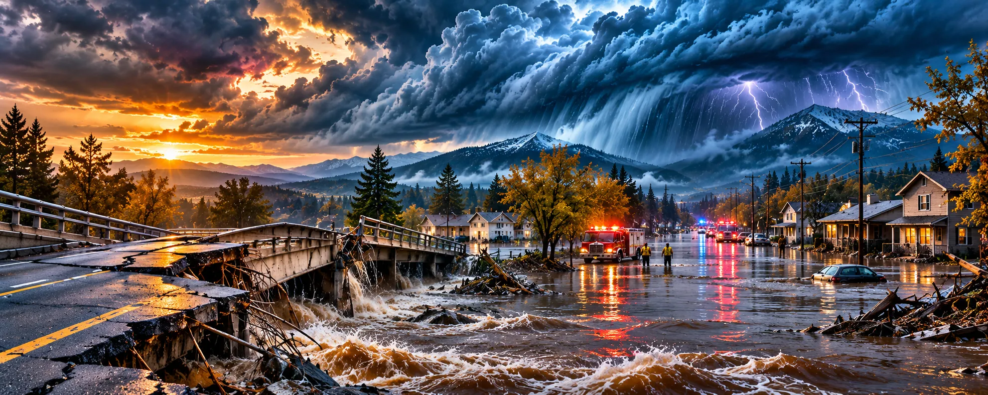
Third Atmospheric River — Infrastructure Under Pressure: A further storm reaches the same region before recovery is complete. Communities may face prolonged flooding, compromised bridges, power outages, damaged water systems, agricultural losses, and emergency-response resources stretched across multiple affected areas.
Under these circumstances, three moderate-to-strong storms could cause more cumulative damage than one exceptionally powerful system. Roads and bridges may remain closed while additional rainfall arrives, reservoirs and rivers may already be elevated, and communities could face repeated evacuations. The situation becomes especially challenging when recovery crews must respond to new emergencies before completing repairs from earlier storms.
The potential consequences extend beyond California. Pacific systems can affect the Southwest and interior western states, while separate winter storms may bring heavy rainfall to portions of the Gulf Coast and Southeast. The defining concern is cumulative exposure: repeated storms, saturated terrain, overlapping flood zones, and progressively reduced recovery time.
THE NOVEMBER WEATHER SETUP — EARLY SIGNALS ARE ALREADY EMERGING
The developing Pacific storm pattern provides an important near-term perspective. Forecast discussions for early and mid-November have highlighted the potential for strong low-pressure systems, atmospheric-river moisture, heavy coastal rainfall, and mountain snowfall across portions of the western United States.
As Pacific storms move inland, their impacts depend on several factors. These include the strength and direction of moisture transport, the elevation of freezing levels, the condition of existing snowpack, and how much precipitation falls over already saturated watersheds. A system that produces beneficial mountain snow in one region may create flooding or landslide hazards elsewhere.
The Pacific Northwest, Northern California, and the Sierra Nevada deserve particular attention during active storm periods. Powerful coastal systems can bring damaging winds alongside heavy precipitation, while inland mountain ranges may experience significant snowfall. The exact locations and severity of these impacts will become clearer as individual storms approach.
These conventional forecasts do not confirm the experimental prediction of three major winter atmospheric rivers. They do, however, demonstrate why the Pacific storm track warrants continued monitoring. For communities across the West, the most useful indicators are storm frequency, rainfall intensity, mountain snow levels, river conditions, and whether successive systems begin affecting the same areas.

SUPER EL NIÑO — THE POTENTIAL CLIMATE DRIVER
The larger weather discussion also centers on the possibility of a strong El Niño influencing the 2026–2027 winter season. El Niño develops when ocean temperatures in the central and eastern tropical Pacific become unusually warm, altering atmospheric circulation and influencing weather patterns far beyond the Pacific Basin.
These changes can shift jet streams, storm tracks, and seasonal precipitation patterns across North America. Some regions may experience wetter conditions, while others see different temperature or rainfall patterns. However, even a strong El Niño cannot determine the exact location, timing, or severity of individual storms months in advance.
The Difference Between Climate Patterns and Storm Forecasts
El Niño provides a broad seasonal influence rather than a precise weather prediction. Its strength can help forecasters assess the likelihood of certain regional conditions, but local outcomes also depend on shorter-term atmospheric patterns and other climate influences.
The experimental Creation Unified scenario proposes an additional mechanism involving overlapping solar, lunar, and terrestrial cycles. According to that hypothesis, the alignment of these cycles could amplify atmospheric responses beyond what conventional forecasting models anticipate. This mechanism remains unverified, and it should not be confused with established El Niño research.
The critical question is whether the combination of El Niño, Pacific storm-track activity, and regional atmospheric conditions will produce an unusually persistent and concentrated period of extreme weather.
SPRING 2027 — A CONCENTRATED SEVERE-WEATHER OUTBREAK?
MARCH THROUGH EARLY MAY 2027
The third scenario shifts attention from Pacific flooding to the southern and southeastern United States. Between March and early May 2027, the experimental outlook identifies the possibility of repeated severe-weather outbreaks across eastern Texas, the lower Mississippi Valley, the Tennessee Valley, and portions of the Southeast.
These regions already experience substantial spring storm activity. Warm, moisture-rich air from the Gulf can interact with advancing frontal systems, atmospheric instability, and strong wind shear. Under favorable conditions, these ingredients can support organized thunderstorms, tornadoes, large hail, damaging winds, and flash flooding.
What distinguishes the proposed scenario is the possibility of multiple outbreaks occurring within a relatively short period. A community recovering from tornado damage could face another severe storm before electrical service, transportation routes, and damaged structures have been restored. Agricultural regions might encounter repeated flooding or crop losses, while emergency responders face several periods of elevated demand.
The experimental timeline identifies this clustering as a potential defining feature of spring 2027. However, the timing and severity of individual outbreaks cannot be reliably established this far in advance. The indicators to monitor will be the frequency of organized storm systems, repeated impacts on vulnerable communities, and whether cumulative damage becomes unusually significant.
CONNECTING THE DOTS — WEATHER, INFRASTRUCTURE & ECONOMIC VULNERABILITY
The consequences of extreme-weather convergence extend well beyond rainfall totals, wind speeds, or storm classifications. When multiple disasters occur within compressed periods, their effects can spread across transportation networks, utilities, agriculture, insurance markets, public services, and regional economies. The damage from one event can make communities more vulnerable to the next.
Flooded highways and damaged bridges interrupt freight movement and delay essential deliveries. Electrical outages affect communications, manufacturing, water treatment, and commercial operations. Agricultural flooding can damage crops and disrupt distribution networks, while insurance claims and reconstruction expenses place additional pressure on households, businesses, and local governments.
When Recovery Capacity Becomes the Breaking Point
These problems become more serious when another storm arrives before repairs are complete. Emergency shelters may still be occupied as new evacuations begin, and municipal budgets already strained by reconstruction may face additional expenses. Communities dependent on a limited number of transportation corridors can experience prolonged isolation when those routes remain damaged or inaccessible.
This is the compound disaster scenario at the center of the original Sleeping Giant warning. The consequences of extreme weather depend not only on the intensity of the atmosphere, but also on the condition of the systems exposed to it. Aging infrastructure, development in flood-prone areas, saturated terrain, limited emergency resources, and inadequate recovery time can turn repeated storms into an extended regional crisis.
The economic impact may therefore exceed what individual storm assessments initially suggest. A sequence of damaging events can create disruptions that continue long after the rain stops or the winds subside, particularly when infrastructure failures affect several interconnected sectors at once.
THE KEY WARNING SIGNALS — WHAT TO WATCH THROUGH SPRING 2027
The coming months offer an opportunity to evaluate the experimental weather scenario against measurable conditions. Rather than assuming that the proposed events will occur, the focus should remain on observable patterns and whether those patterns begin to resemble the original timeline.
The most important indicators are:
- El Niño intensity: Whether Pacific oceanic and atmospheric conditions continue supporting strong-to-very-strong El Niño conditions.
- Atmospheric-river frequency: Whether California and the Pacific Northwest experience repeated significant moisture-transport events during the winter.
- Storm clustering: Whether two or three major systems affect overlapping regions before soils, rivers, and infrastructure have recovered.
- Flooding severity: Whether rainfall totals, river crests, landslides, and infrastructure damage become unusually significant.
- Regional weather contrasts: Whether some areas experience exceptional precipitation while others remain unusually dry or encounter different weather extremes.
- Spring severe-weather concentration: Whether tornado, hail, damaging-wind, and flash-flood outbreaks cluster across the southern and southeastern United States.
- Cumulative economic disruption: Whether repeated events produce prolonged transportation, utility, agricultural, insurance, or municipal-service impacts.
These markers offer a practical framework for monitoring the season without assuming that every proposed event will occur.
Preparedness remains the most practical response, regardless of whether these predictions prove accurate. Residents in vulnerable areas should follow National Weather Service alerts, understand local flood and storm exposure, review evacuation routes, and maintain essential emergency supplies. The objective is not to anticipate every possible disaster, but to reduce vulnerability when severe weather develops.
FINAL ORIENTATION | THE GREAT WEATHER CONVERGENCE
The developing 2026–2027 weather outlook brings several important considerations into focus. An evolving Pacific climate pattern, the potential for repeated atmospheric-river flooding, and the possibility of concentrated spring severe weather all deserve attention. The experimental Creation Unified simulation offers a specific timeline to examine, while conventional meteorological observations provide the evidence needed to determine which risks are actually emerging.
The greatest concern is not whether one powerful storm strikes California or a severe-weather outbreak affects the Southeast. It is whether multiple high-impact systems arrive within compressed periods, creating cumulative consequences that extend beyond the immediate disaster areas. Under those conditions, infrastructure damage, economic disruption, and limited recovery time may become as important as the storms themselves.
THE CENTRAL WARNING: WHEN MULTIPLE EXTREME-WEATHER SYSTEMS ARRIVE IN RAPID SUCCESSION, THEIR COMBINED EFFECTS CAN OVERWHELM THE RECOVERY CAPACITY OF COMMUNITIES, INFRASTRUCTURE, AND REGIONAL ECONOMIES.
The months ahead will determine whether the proposed sequence materializes. Until then, the most responsible approach is to monitor the evidence, recognize emerging patterns, and remain prepared without treating uncertain predictions as inevitable outcomes.
SOURCES & FURTHER READING
- NOAA Climate Prediction Center | ENSO Diagnostic Discussion
- NOAA Climate Prediction Center | Weather Hazards Outlook
- National Weather Service | Weather Prediction Center
- Center for Western Weather and Water Extremes | Atmospheric River Research
- Creation Unified | 2026–2027 Experimental Weather Scenario

Sign up to receive Our Weekly Briefing Newsletter
Begin your journey with weekly insights designed to expand awareness and ground you in truth. Our free tier gives you a powerful introduction without any commitment.
STOP DROWNING IN THE NOISE. START SEEING THE TRUTH. Join thousands of truth seekers. Get the essential intelligence, alternative news, and disclosure updates that the mainstream media won’t touch.
Latest Reports
 Weekly ReportAwakening The Sleeping Giant · November 2nd EditionNovember 2, 2026
 Monthly Report• November 2026 • Volume IX • Chapter XINovember 2, 2026
 Weekly ReportAwakening The Sleeping Giant · October 26th EditionOctober 26, 2026
 Weekly ReportAwakening The Sleeping Giant · October 19th EditionOctober 19, 2026View all weekly reports
Special Reports
 Special ReportGlobal Everything Collapse · Crossing The Threshold · Part IIINovember 6, 2026
 Special ReportThe Next Plandemic, The Bird Flu VirusNovember 5, 2026
 Special ReportThe Great Exodus, California On The ThresholdOctober 20, 2026
 Special ReportThe Sovereign Household: How to Prepare for Economic CollapseOctober 14, 2026View all special reports
Help Us Bypass Censorship. Share This.
Join the Discussion
Related Posts


Have questions?
At Great Awakening Report, we are dedicated to supporting your journey toward truth and enlightenment through our specialized Coaching and Consulting services.
Coaching Services: Our coaching programs are designed to guide you through personal awakening and transformation. We offer personalized sessions that focus on expanding consciousness, uncovering hidden truths, and fostering spiritual growth. Our experienced coaches provide the tools and insights necessary to navigate your path with clarity and confidence.
Consulting Services: For organizations and individuals seeking deeper understanding and strategic guidance, our consulting services offer expert analysis and solutions. We delve into areas such as global transitions, alternative news insights, and consciousness studies to provide comprehensive strategies tailored to your unique objectives.
Embark on a transformative journey with our Coaching and Consulting services, and unlock your highest potential. To learn more and schedule a session, visit our Coaching and Consulting pages.
Thank you
Thank you to our subscribers and readers for your continued support and dedication to truth and awakening. Your encouragement, engagement, and belief in our mission make everything we do possible. Together, we are expanding awareness and helping illuminate the path forward.
If you would like to further support the Great Awakening team and our ongoing efforts to share insight, knowledge, and truth, you can DONATE HERE.
With deep gratitude,
– Great Awakening Team
About the Author: Great Awakening Team

We are a community. We are cultural creatives and like minded people seeking the truth and focusing on disclosure, awakening and consciousness. Our focus is real news as researchers, reporters and truth seekers. We are here to teach, to spread the word, to serve and to help. We are a collective, a movement, free from all programing, not closed minded and not discriminatory. We are not political. We are not religious but we are spiritual. We study, research, and report on a wide range of subjects and topics, from the current geopolitical climate to health and wellness, from earth’s history to spiritual practices. We are forward thinkers and visionaries, we are guides for the transition as we usher in The Great Awakening.
THIS WEBSITE DOES NOT PROVIDE MEDICAL ADVICE: The information, including but not limited to text, graphics, images, and other material contained on this website, are for informational purposes only. No material on this site is intended to be a substitute for professional medical advice, diagnosis, or treatment. Always seek the advice of your physician or other qualified health care provider with any questions you may have regarding a medical condition or treatment and before undertaking a new health care regimen, and never disregard professional medical advice or delay in seeking it because of something you have read on this website.
DISCLAIMER: All statements, claims, views and opinions that appear anywhere on this site, whether stated as theories or absolute facts, are always presented by The Great Awakening Report (GAR) as unverified—and should be personally fact checked and discerned by you, the reader.Any opinions or statements herein presented are not necessarily promoted, endorsed, or agreed to by GAR, those who work with GAR, or those who read or subscribe to GAR.Any belief or conclusion gleaned from content on this site is solely the responsibility of you the reader to substantiate.Any actions taken by those who read material on this site are solely the responsibility of the acting party.You are encouraged to think for yourself and do your own research.Nothing on this site is meant to be believed without question or personal appraisal.
COPYRIGHT DISCLAIMER: Citation of articles and authors in this report does not imply ownership. Works and images presented here fall under Fair Use Section 107 and are used for commentary on globally significant newsworthy events. Under Section 107 of the Copyright Act 1976, allowance is made for fair use for purposes such as criticism, comment, news reporting, teaching, scholarship, and research.
COMMUNITY GUIDELINES DISCLAIMER: The points of view and purpose of this video is not to bully or harass anybody, but rather share that opinion and thoughts with other like-minded individuals curious about the subject.